Dimensions : 400 X 530 X 40 mm
No. 28
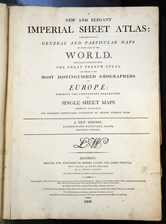
LAURIE, Robert and WHITTLE, James. A New and Elegant Imperial Sheet Atlas: Comprehending General and Particular Maps of Every Part of the World
Principally compiled from The Great French Atlas, and others of the Most Distinguished Geographers in Europe: Forming the Completest Collection of Single Sheet Maps hitherto published and rendered particularly convenient by opening without folds.
Robert Laurie and James Whittle, London 1808. Folio. Letterpress title and contents leaf, 56 engraved maps (53 double-page, of which, 6 are folding), fine original full body-colour throughout, each map mounted on guards, 7 maps with split to centre-fold, initial blank inscribed 'To J.M.M. Weller Esq. from his affte. friend John Baird', full calf with gilt lettered red morocco label to spine, rubbed and scuffed, marbled endpapers, front free endpaper detached.
A particularly attractive example with fine body colour to the seas as well as the land. The atlas begins with a very grand double hemisphere world map and includes 11 maps relating to the Americas and the West Indies; including a general map of the 'United States of America' extending west as far as the Mississippi. Also present are separate maps for Arabia, China and Japan, together with a curious circular map of '700 miles round London'.