
Dimensions : 405 X 520 X 20 mm
No. 29
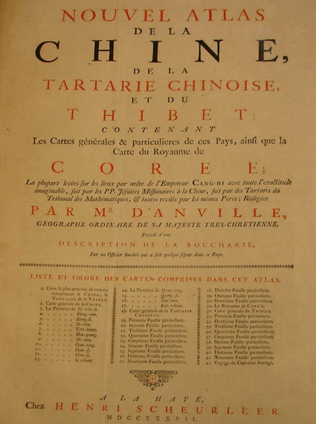
ANVILLE, Jean Baptiste B. D'. Nouvel Atlas de la Chine, de la Tartarie Chinoise, et du Thibet: Contenant Les Cartes générales & particulieres de ces Pays, ainsi que la Carte du Royaume de Coree
Henri Scheurleer, The Hague 1737. First Edition. Folio, engraved title, 2pp. advertisement, and 8pp., 42 engraved maps, as called for, the two general maps in original outline colour, old boards with vellum spine, chipped and worn, inner hinges taped.
A rare and detailed atlas of China's provinces, published to accompany Pere J.B. du Halde's "Description géographique, historique, chronologique, et physique de l'empire de la Chine". It is important not only for the most important set of maps of China since the Blaeu/Martini atlas, but also for the first separate European maps of Korea & Bhutan and the first serious study of Tibet (a ten-sheet map).